1. What is necessary to consider when choosing the location of a new site?
Defining the measurement location is commonly defined as the most critical task in hydrometry in order to obtain accurate results. With the DischargeApp, you can easily and quickly obtain results within an uncertainty of 20 % and under good conditions, within 10 %. For this, you however need to make sure that:
- the river considered has a prismatic cross-section over its span, prismatic meaning here constant.
- the roughness of the bed should be fairly homogeneous, so that defining a K-Strickler coefficient is meaningful.
- as Discharge is an optical method relying on visible light, the site should be well illuminated.
Note that as the site setup is fairly fast (less than 1 hour), if you encounter difficult conditions (e.g. illumination), we recommend to install several sites close to another on the same river (2 - 3 sites). You can then choose the site working best depending on the conditions to perform your measurement.
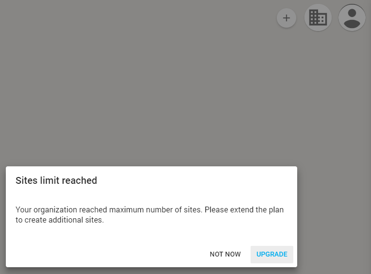
2. I would like to create a site but it is not possible, what is going on?
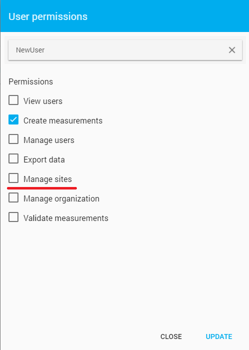
This could be mainly due to two different reasons. First, you may not are granted with the permission to create a site. For every administration, there is an administrator controlling the permissions of the users (e.g. view users, create measurements, manage sites etc.). In order to get these permissions, contact the administrator (email available under the organization tab). Alternatively, you also may want to create your own organization. Secondly, it can also be that you reached the maximal amount of sites available for the plan you have. In this case, you will need to update to another plan.
3. How can I set markers and perform measurements in an optimal way?
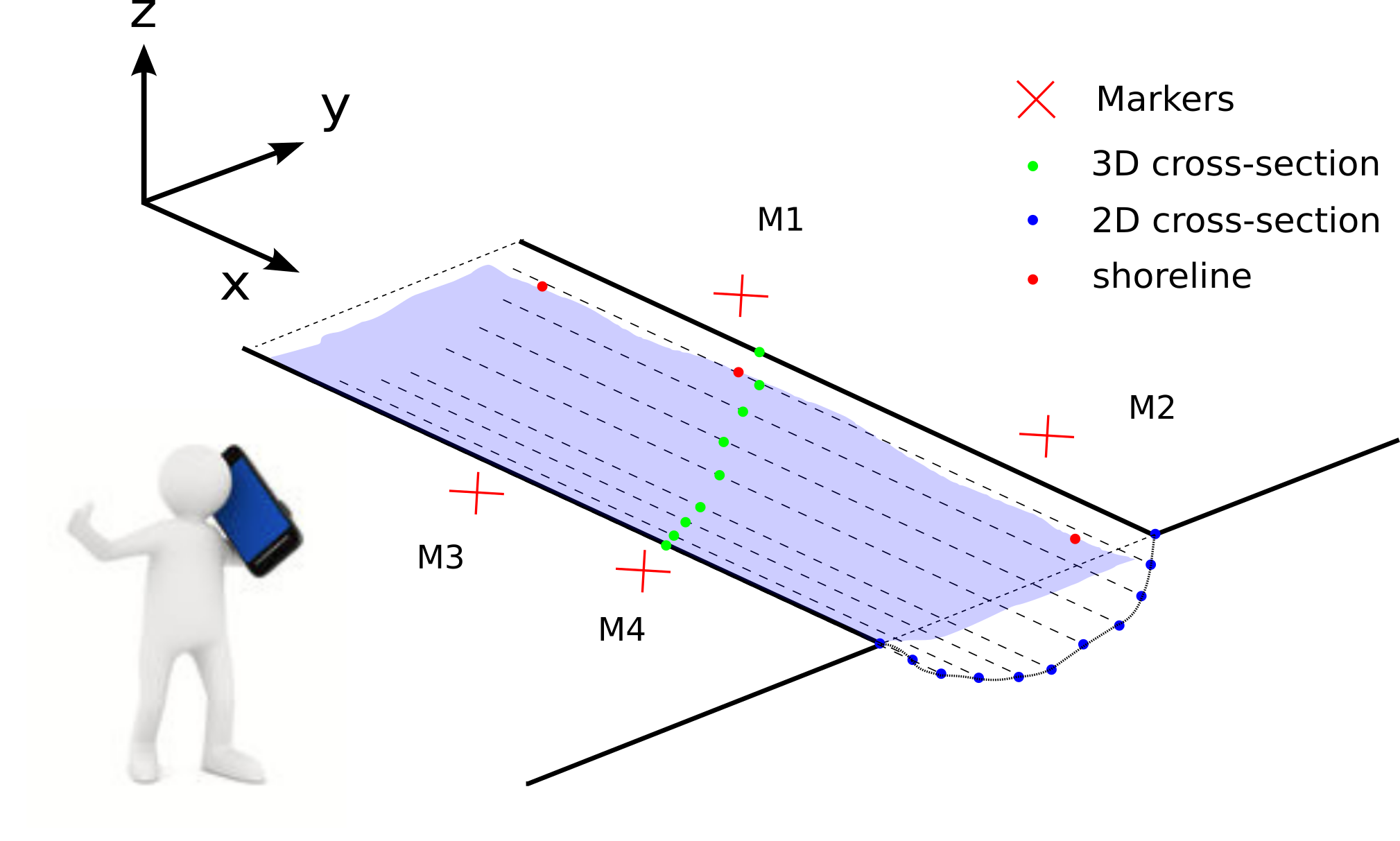
First, if you are using a standard profile (rectangular, trapezoidal or parabolic), it is necessary that all markers are located in a same plane parallel to the water surface. If this is not possible, you’ll have to choose a free cross-section instead.
Second, it is very important to make a maximal use of the field of view provided by the camera of your smartphone, so that the river cross-section can be captured at a resolution as high as possible. Therefore, the markers on the far shore should be more distant from another than the ones on the near shore. Before performing the measurement, make sure that your position and the orientation of the smartphone allows you to maximize the area covered by the river cross-section in the field of view.
Define the markers as crosses and not as circles and always consider the line intersection as a reference, this will allow you to measure the distances in an accurate way. If needed, you can use a stencil to pain the markers.
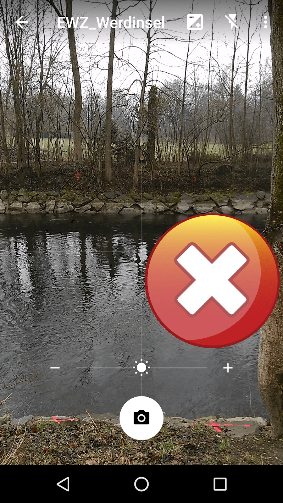
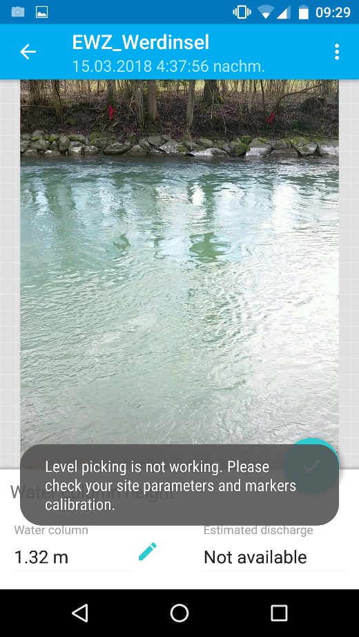
4. What does the error message “Level picking not working” mean?
This error message means that the DischargeApp is not able to calibrate (registering the user’s position to the site as defined by the markers). It either means that the site calibration has a bug (distance between markers etc.) or that the markers were not selected accurately enough within the App.
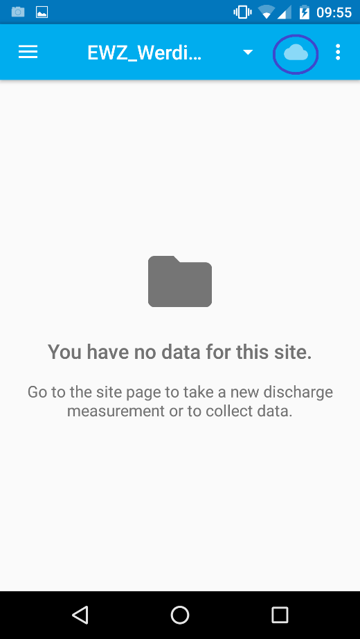
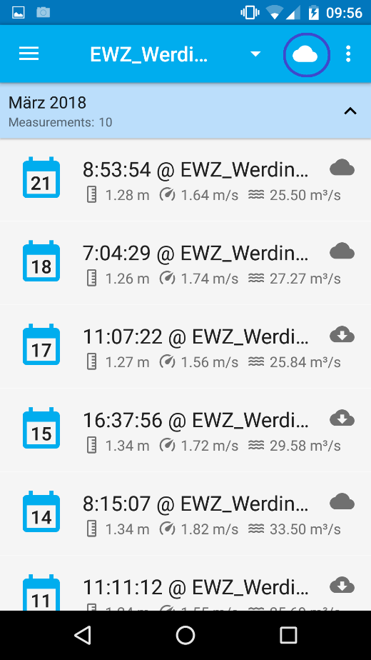
5. Some uploaded measurements are not available anymore, what happened?
In the measurements tab, by selecting the cloud button, you can choose between showing measurements that saved locally on your device or that were already updated to the cloud.
If you are not able to see one of your measurements, it is probably because you just uploaded it to the cloud. Select the cloud button to see if this solves your problem.
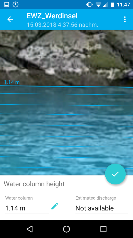
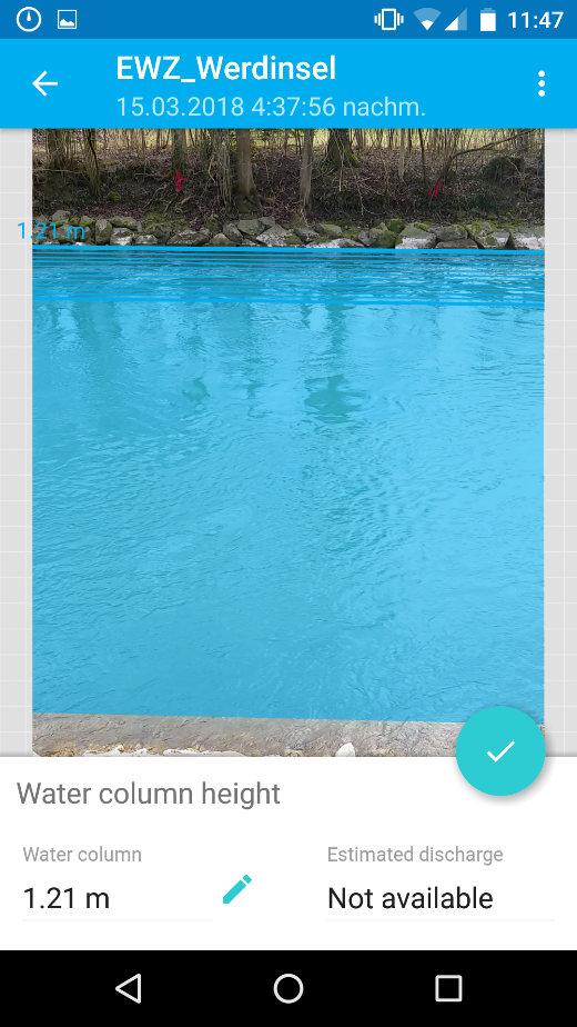
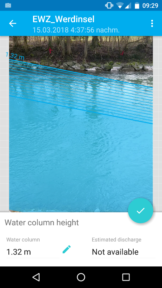
6. How can I set the water level optimally?
Setting the water level correctly is absolutely crucial in order to obtain accurate results. By using the two fingers zoom functionality while setting the markers, you can ensure that you set the level as accurately as possible.
7. How long is it possible to use the sites for?
The “life expectancy” of Discharge sites depends strongly on the dynamics of hydrological processes at the site location. For instance, if flood events regularly modify the cross-section that you measured, it will be necessary to redefine the cross-section to obtain accurate data.
Note that such flood events can also substantially change the Strickler coefficient entered. The same Strickler coefficient can also change seasonally with development of vegetation within the river bed.
However, if you repaint markers regularly, the site can be used for several years without any problems. You may want to clean the shores every once in a while to be able to define the water level in an accurate way.
Additionally, if you are working with a cement channel, you may want to remove deposited sediment regularly to keep a constant Strickler coefficient.
8. I cannot set the level correctly on the App, what is going on? Additionally, the level obtained is not parallel to the shoreline on the far side.
If the level detected by the DischargeApp on the far shore is not parallel to the shoreline, you may have some issues with the calibration.
Make sure that you entered selected the markers correctly in the DischargeApp and if the problem remains, you’ll have to measure the distances between the markers again.
If this does not allow to solve the problem, the markers you defined may not be located in a single plane parallel to the water surface. This means that entering a free cross-section is necessary.
9. How accurate is the App?
The DischargeApp is very accurate. We are still working on an official certification, but from our experience, when it is used appropriately on sites that were defined correctly, the relative error obtained with the DischargeApp is below 5%.
In order to increase the accuracy of the results obtained by the App, we recommend to perform several measurements and to average them. Depending on the site and on the conditions (flow, illumination etc.), performing several measurements might allow to improve the accuracy of the DischargeApp.
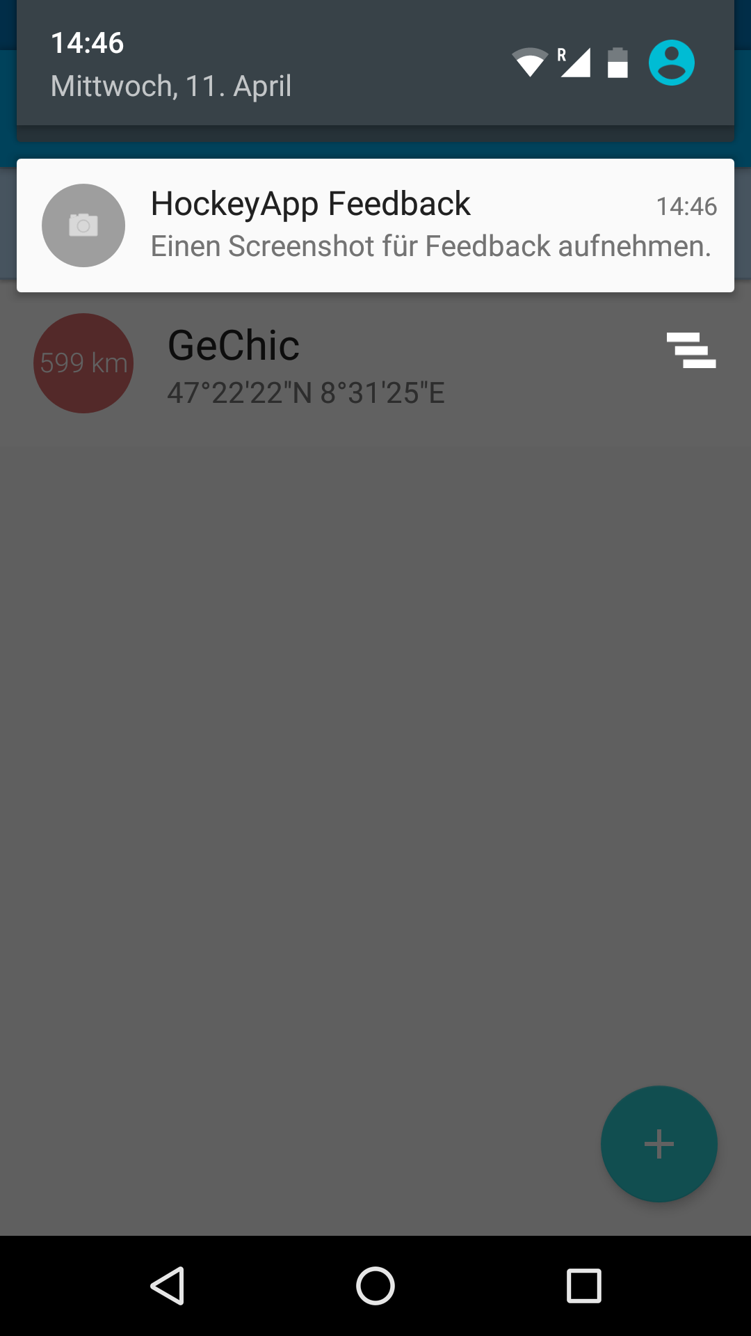
10. What is the HockeyApp Feedback?
The HockeyApp is a tool that we use at Discharge to collect your feedback if you are facing problems when using the App. So if you do, do not hesitate to perform a screenshot and send you a message explaining your problem. We will then answer your request as soon as possible.
11. How much does it cost?
Our principle is that you will only pay for what you really need. We offer different plans, that may even be customized to your needs. Discharge is taking into account that different regions of the world have different price levels.
12. How can I pay?
Payments for discharge can be made either by bank transfer, by paypal, or by credit card.
13. How do I get started?
Please install the
discharge app. Opening the app or visiting the site discharge.ch will guide you quickly through the signup process and off you go. The help documentation explains the first steps. Help is available once signed in, either in the web app discharge.ch or in the mobile app 'discharge'.
14. What smartphone do I need?
You need an Android smartphone, like: SAMSUNG GALAXY S4, S5, S7 Edge, A3, A5, SONY Xperia Z1 compact, TECHNO W3, OPPO Neo 7, LG G3, HTC 10. Basic device specifications: Android 4.1 or higher, Smartphone Camera: 25 fps video, ARM processor.
15. Who can provide service and support?
The discharge team will happily answer minor questions. More involved support is provided by photrack, hydrosolutions and by SEBA hydrometrie. Help and support can even be provided by yourself! Check out our
Franchising program.
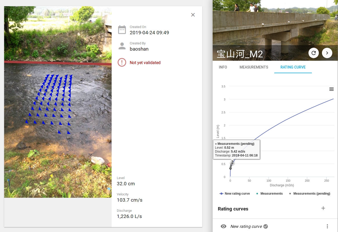
16. How does the rating curve tool work?
If needed, it is possible to define a rating curve for a measurement site. The rating curve can either be obtained by fitting a function to the data measured with the DischargeApp or using results from other measurement methods (see Figure 1). Once that a rating curve is defined, you can see an estimate of the discharge directly after measuring the water level. Note that if the estimate is kept and uploaded, no velocity values will be shown for this measurement. Processing of the movie to compute the discharge based on the surface velocity measurement would be possible at all times.
Figure 1
Example of measurements obtained with the DischargeApp and of a rating curve. The rating curve shown here was created using Manning-Strickler formula, assuming uniform flow conditions.
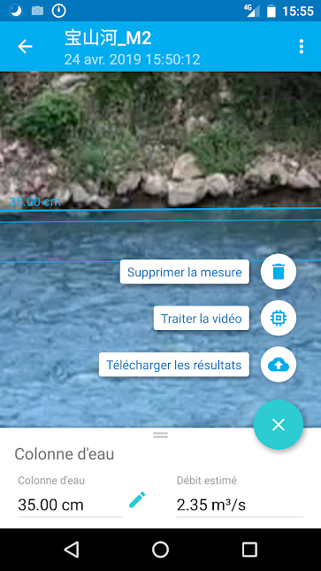
Figure 2
After the water level measurement, the discharge can be estimated based on the defined rating curve.
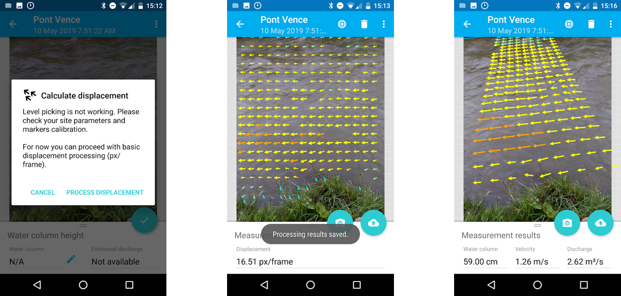
17. What is the pix-per-frame or process displacement tool?
The pix-per-frame tool is a feature allowing you to assess the suitability of a potential site for
measurements with the DischargeApp. With it, you can record a movie and calculate the signal or
displacement field in pixels per frame using our SSIV technology, without having calibrated the site.
For this create a new site, record a movie and select the process displacement button.
Once you are sure that the signal is good enough (warm colors like yellow, orange and red indicate a
good signal, blue and green colors, a rather week signal) you can set up the site, process the data again,
obtain the velocity field at the river surface and the corresponding discharge value.
Possibility of calculating the displacement (left), displacement field in pixels per frame (middle) and velocity field at the surface of the river, once the site is calibrated (right).